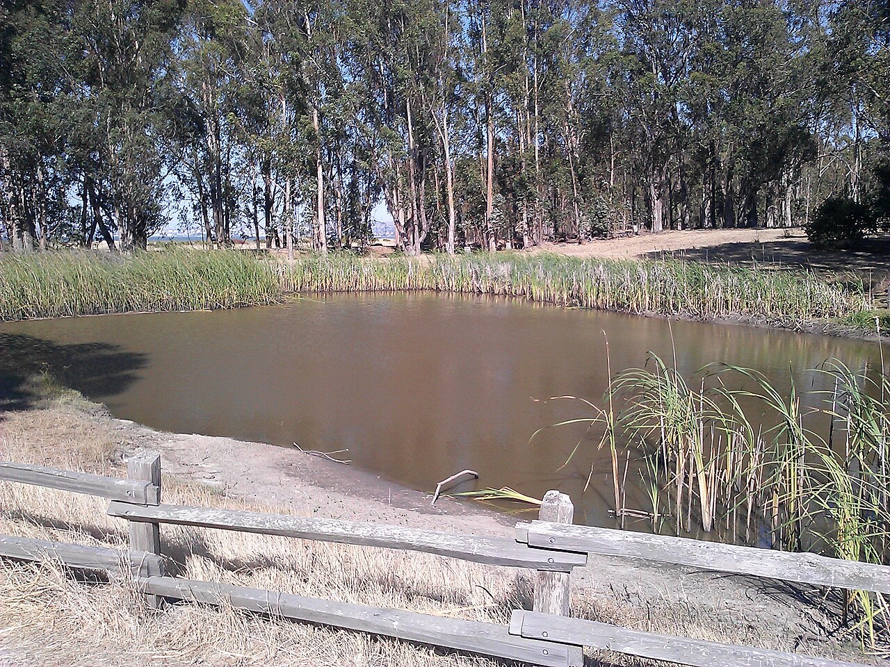
Point Pinole Regional Shoreline
Richmond, Contra Costa County, CA
- Size
- 2,203 acres Source
- Managed by
- East Bay Regional Park District
About Point Pinole Regional Shoreline
A Richmond shoreline park with bay trails, a fishing pier, and camping. Source
The journey is as scenic as the destination at Point Pinole Regional Shoreline, a 2,432-acre parkland right next to densely populated Pinole, Richmond, and San Pablo. Trails lead through breezy meadows with wildflowers in season, through aromatic eucalyptus woods, or along bluffs and beaches on San Pablo Bay. There are beautiful views of Mt. Tamalpais, the Marin shoreline, and San Pablo Bay with its sailboat and shipping traffic.
Facilities
- Drinking Water
- Fishing
- Historic Site
- Picnic Area
- Playground
- Restrooms
- Tennis Courts
- Volleyball
Facility details: OpenStreetMap
Point Pinole Regional Shoreline at a glance
- PParking · 2: Pinole Point parking
- WCRestrooms · 7
- WDrinking water · 7
- TTrailheads · 2: Dotson Family Marsh Staging Area, Atlas Road Staging Area
- Named trails · 12
Outline: CPAD. Points and trail lines: OpenStreetMap contributors. Not for navigation.
Trails
| Trail | Mapped length | Elevation | Surface & uses |
|---|---|---|---|
| Bay View Trail | 1.7 mi | 199 ft up & down24–78 ft | BikesHorsesUnpaved |
| Pinole Point Trail | 1.5 mi | 140 ft up & down11–84 ft | PavedBikesHorses |
| Bay Trail | 1 mi | 20 ft up & down5–15 ft | Paved |
| Woods Trail | 0.8 mi | 59 ft up & down31–82 ft | BikesHorsesUnpaved |
| Owl Alley Trail | 0.8 mi | 54 ft up & down11–41 ft | BikesHorses |
| Cook's Point Trail | 0.8 mi | 89 ft up & down25–75 ft | UnpavedBikesHorses |
| Marsh Trail | 0.7 mi | 38 ft up & down10–25 ft | BikesHorses |
| Giant Station Trail | 0.7 mi | 80 ft up & down51–102 ft | UnpavedBikesHorses |
| Packhouse Trail | 0.6 mi | 66 ft up & down49–117 ft | BikesHorses |
| Rough Trail | 0.4 mi | 38 ft up & down31–49 ft | UnpavedNo bikesNo horses |
| Cooks Point Trail | 0.4 mi | 23 ft up & down9–28 ft | BikesHorses |
| China Cove Trail | 0.3 mi | 41 ft up & down8–54 ft | BikesHorses |
Trail names and mapped lengths come from OpenStreetMap; lengths count only the part inside the park boundary. Up-and-down totals (climbing plus descent, one way) and elevation ranges are estimates from USGS 3DEP elevation (about 15 m grid) sampled along the mapped line. Use the official guide map for the route and current closures.
Getting to Point Pinole Regional Shoreline by bus
- West County Detention Facility · Routes 71, 376 · 730 ft from the park
Bus stops within about a quarter mile of Point Pinole Regional Shoreline, mapped in OpenStreetMap. Check the transit agency for schedules.
Rules & reservations
Official park page- Dogs
Dogs must be leashed in parking lots, picnic areas, lawns, and other developed areas, and may be off leash under control in undeveloped open space (district rules). Dogs are not allowed on the pier. Source
Gate hours change through the year; check the posted schedule.
Map & directions
5551 Giant Highway, Richmond, CA 94806
Nearby parks
Straight-line distanceContinue exploring
Contra Costa County parks Parks in Richmond PlaygroundsSources & verification
Last verified: Oct 15, 2026- California Protected Areas Database (CPAD) 2026aname, county, agency, access, acres
- East Bay Regional Park District dog rulesdogs
- East Bay Regional Park District park pageofficial_url, hours, address, description, fees, dogs
- OpenStreetMap facilities and trailsfacilities.drinking-water, facilities.fishing, facilities.historic-site, facilities.picnic-area, facilities.playground, facilities.restrooms, facilities.tennis-court, facilities.volleyball, trails
- U.S. Census Bureau place boundariescity
- OpenStreetMap: parking, restrooms, water, trailheads, trail lines, and bus stopsvisit
- Terrain Tiles elevation (USGS 3DEP), sampled every 20 m along OpenStreetMap trail linestrails.elevation
- Official park page (introduction excerpt)intro