Frank G. Bonelli Regional Park
San Dimas, Los Angeles County, CA
- Size
- 1,821 acres Source
- Managed by
- Los Angeles County Parks and Recreation
About Frank G. Bonelli Regional Park
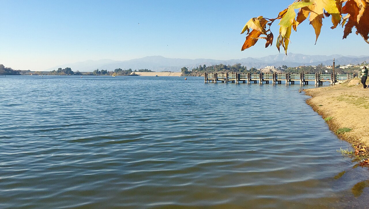
Frank G. Bonelli Regional Park is a beautiful 1,800 acre facility featuring a 250 acre lake with 14 miles of multi-use trails. Bonelli Park offers a wide variety of recreational activities, including boating, jet skiing, fishing, swimming, family and group picnicking, nature walks, hiking, jogging, and biking. There are also concessionaires offering RV Camping, Hot Tubs, Wedding Facilities, and Horse Back Riding.
Facilities
- BBQ Grills
- Boat Launch
- Picnic Area
- Playground
- Restrooms
- Fishing
- Swimming
Facility details: official park information
Frank G. Bonelli Regional Park at a glance
- PParking · 27
- WCRestrooms · 8
- Named trails · 9
Outline: CPAD. Points and trail lines: OpenStreetMap contributors. Not for navigation.
Trails
| Trail | Mapped length | Elevation | Surface & uses |
|---|---|---|---|
| Bonelli Trail | 8.6 mi | 2,673 ft up & down789–1,212 ft | BikesHorsesPaved |
| Park View Trail | 1.8 mi | 533 ft up & down998–1,219 ft | BikesHorses |
| Lake View Trail | 1.4 mi | 437 ft up & down942–1,129 ft | |
| Kikos Trail | 0.6 mi | 278 ft up & down957–1,238 ft | BikesHorses |
| Lower Bee Hive Trail | 0.4 mi | 111 ft up & down1,009–1,087 ft | BikesHorses |
| Tree Line Trail | 0.3 mi | 176 ft up & down949–1,105 ft | BikesHorses |
| Vargus Trail | 0.3 mi | 169 ft up & down923–1,111 ft | BikesHorses |
| Eucalyptus Park Road | 0.1 mi | 33 ft up & down949–996 ft | |
| Marshall Canyon Trail | 0.1 mi | 9 ft up & down963–976 ft | Horses |
Trail names and mapped lengths come from OpenStreetMap; lengths count only the part inside the park boundary. Up-and-down totals (climbing plus descent, one way) and elevation ranges are estimates from USGS 3DEP elevation (about 15 m grid) sampled along the mapped line. Use the official guide map for the route and current closures.
Rules & reservations
Official park page- Dogs
County code allows dogs in county parks on a leash no longer than 6 feet and under full control; dogs may be off leash only in designated off-leash areas. Posted park rules may add restrictions. Source
March 1 to October 31. November 1 to February 28: Wed–Sun, 6 a.m. to 7 p.m.
Map & directions
120 Via Verde Park Rd., San Dimas, CA 91773
Nearby parks
Straight-line distanceContinue exploring
Los Angeles County parks PlaygroundsSources & verification
Last verified: Oct 15, 2026- California Protected Areas Database (CPAD) 2026aname, county, agency, access, acres
- LA County Parks park page (hours and description re-read in a browser)hours, hours_note, description
- LA County Parks park page (read in a browser)official_url, address, facilities.bbq-grills, facilities.boat-launch, facilities.playground, facilities.fishing, facilities.picnic-area, facilities.restrooms, facilities.swimming
- LA County Parks fee schedule (vehicle entrance)fees
- Los Angeles County Code 17.04.410 (dogs in parks)dogs
- OpenStreetMap facilities and trailstrails
- U.S. Census Bureau place boundariescity
- OpenStreetMap: parking, restrooms, water, trailheads, trail lines, and bus stopsvisit
- Terrain Tiles elevation (USGS 3DEP), sampled every 20 m along OpenStreetMap trail linestrails.elevation
- Official park page (introduction excerpt)intro