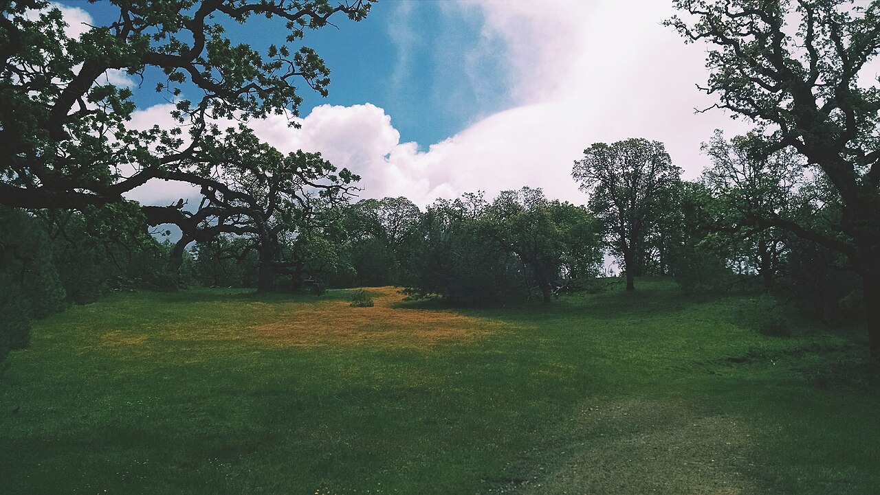
Ohlone Wilderness Regional Preserve
Livermore, Alameda County, CA
- Size
- 5,442 acres Source
- Managed by
- East Bay Regional Park District
About Ohlone Wilderness Regional Preserve
A 9,737-acre wilderness reached only by trail, centered on 3,817-foot Rose Peak. Source
You have to hike or ride horseback to see this magnificent 9,737-acre parkland, accessible only by way of the Ohlone Wilderness Trail. Its centerpiece is 3,817-foot Rose Peak, just 32 feet lower than Mount Diablo. Surrounding Rose Peak are grassy ridges, profusely flowered in season. The abundance of wildlife includes golden eagles, mountain lions, and tule elk.
Facilities
- Camping
- Drinking Water
- Restrooms
Facility details: OpenStreetMap
Ohlone Wilderness Regional Preserve at a glance
- WCRestrooms · 4
- WDrinking water · 5: Strommer Spring-Drinking water(must be treated), Boyd camp water
- Named trails · 10
Outline: CPAD. Points and trail lines: OpenStreetMap contributors. Not for navigation.
Trails
| Trail | Mapped length | Elevation | Surface & uses |
|---|---|---|---|
| Welch Creek Road | 2.2 mi | 1,490 ft up & down1,403–2,854 ft | |
| Buckboard Trail | 1.6 mi | 862 ft up & down2,807–3,548 ft | |
| Bluff Road | 1.3 mi | 1,105 ft up & down1,562–2,666 ft | |
| Rocky Ridge Trail | 1 mi | 259 ft up & down2,249–2,388 ft | No bikesHorses |
| Greenside Road | 1 mi | 458 ft up & down3,060–3,500 ft | |
| Portuguese Point Road | 1 mi | 443 ft up & down2,929–3,543 ft | Unpaved |
| Ohlone Trail | 0.6 mi | 508 ft up & down1,862–2,384 ft | UnpavedNo bikesHorses |
| Stromer Spring Road | 0.4 mi | 321 ft up & down1,925–2,249 ft | No bikesHorses |
| Brogan Route | 0.3 mi | 242 ft up & down2,957–3,309 ft | UnpavedNo bikesNo horses |
| Ohlone Wilderness Trail | 0.1 mi | 34 ft up & down2,390–2,439 ft | UnpavedNo bikes |
Trail names and mapped lengths come from OpenStreetMap; lengths count only the part inside the park boundary. Up-and-down totals (climbing plus descent, one way) and elevation ranges are estimates from USGS 3DEP elevation (about 15 m grid) sampled along the mapped line. Use the official guide map for the route and current closures.
Rules & reservations
Official park page- Dogs
Dogs must be leashed in parking lots, picnic areas, lawns, and other developed areas, and may be off leash under control in undeveloped open space (district rules). Dogs are allowed during daytime only. Source
- Trail permit
A trail permit is not required starting in 2026. Source
Gate hours change through the year; check the posted schedule.
Map & directions
Nearby parks
Straight-line distanceContinue exploring
Alameda County parks Parks in LivermoreSources & verification
Last verified: Oct 15, 2026- California Protected Areas Database (CPAD) 2026aname, county, agency, access, acres
- East Bay Regional Park District dog rulesdogs
- East Bay Regional Park District park pageofficial_url, hours, description, dogs
- OpenStreetMap facilities and trailsfacilities.camping, facilities.drinking-water, facilities.restrooms, trails
- U.S. Census Bureau place boundaries (nearest place)city
- OpenStreetMap: parking, restrooms, water, trailheads, trail lines, and bus stopsvisit
- Terrain Tiles elevation (USGS 3DEP), sampled every 20 m along OpenStreetMap trail linestrails.elevation
- Official park page (introduction excerpt)intro