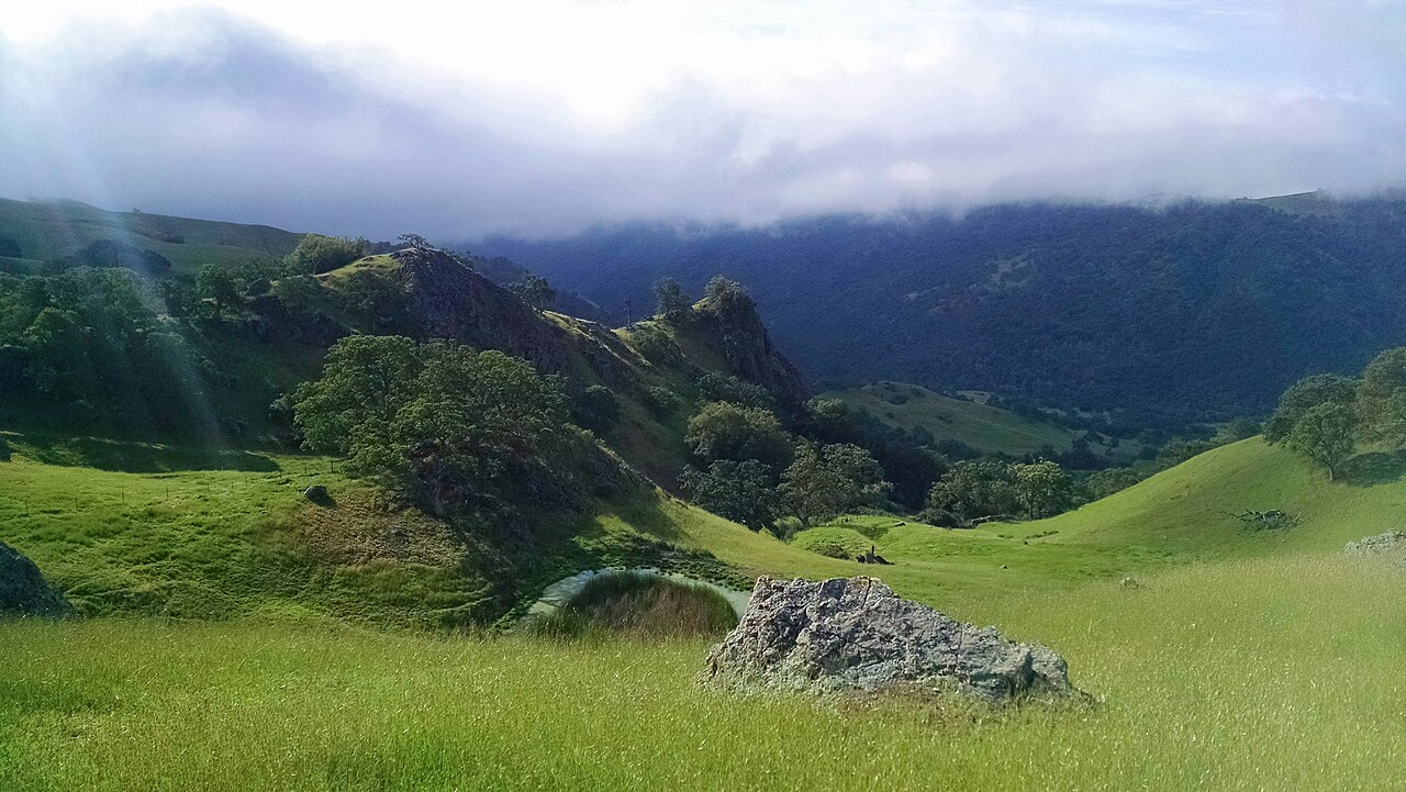
Sunol Wilderness Regional Preserve
Sunol, Alameda County, CA
- Size
- 5,961 acres Source
- Managed by
- East Bay Regional Park District
About Sunol Wilderness Regional Preserve
Former ranchland near Sunol with hiking, horseback riding, and camping. Source
Bedrock mortars used by Native Americans for pounding acorns that were found in the area are reminders of Sunol's first inhabitants. For the past century, however, the land known today as Sunol Wilderness Regional Preserve was used almost exclusively as ranch land. Under the East Bay Regional Park District's multi-use land management policy, cattle continue to graze in the 6,859-acre wilderness.
Facilities
- Camping
- Drinking Water
- Picnic Area
- Restrooms
Facility details: OpenStreetMap
Sunol Wilderness Regional Preserve at a glance
- PParking · 11
- WCRestrooms · 8
- WDrinking water · 6
- Named trails · 10
Outline: CPAD. Points and trail lines: OpenStreetMap contributors. Not for navigation.
Trails
| Trail | Mapped length | Elevation | Surface & uses |
|---|---|---|---|
| Ohlone Wilderness Trail | 4.8 mi | 1,826 ft up & down404–2,426 ft | UnpavedNo bikesHorses |
| Maquire Peaks Loop | 3.1 mi | ||
| McCorkle Trail | 2.7 mi | 1,422 ft up & down429–1,488 ft | UnpavedNo bikesHorses |
| Cerro Este Road | 2.5 mi | 1,547 ft up & down631–2,180 ft | UnpavedBikes |
| Vista Grande Road | 1.7 mi | 1,021 ft up & down1,097–1,864 ft | UnpavedBikes |
| Camp Ohlone Road | 1.6 mi | 408 ft up & down413–691 ft | BikesPavedUnpaved |
| Canyon View Trail | 1.5 mi | 570 ft up & down401–831 ft | No bikesNo horsesHorses |
| Cave Rocks Road | 1.4 mi | 719 ft up & down1,075–1,745 ft | UnpavedBikes |
| Eagle View Trail | 1.3 mi | 637 ft up & down1,294–1,680 ft | UnpavedNo bikesNo horses |
| Indian Joe Creek Trail | 1.2 mi | 684 ft up & down450–1,148 ft | No bikesNo horses |
| Maguire Peak Trail | 1.2 mi | ||
| High Valley Road | 1.1 mi | 459 ft up & down836–1,103 ft | Bikes |
Trail names and mapped lengths come from OpenStreetMap; lengths count only the part inside the park boundary. Up-and-down totals (climbing plus descent, one way) and elevation ranges are estimates from USGS 3DEP elevation (about 15 m grid) sampled along the mapped line. Use the official guide map for the route and current closures.
Rules & reservations
Official park pageGate hours change through the year; check the posted schedule. Visitor center: Fridays 9 a.m.–1 p.m.; weekends and most holidays 8:30 a.m.–4 p.m.
Map & directions
1895 Geary Road, Sunol, CA
37.520164, -121.818899Get directions
Nearby parks
Straight-line distanceMission Peak Regional PreserveFremont · 4.1 mi · Camping, Drinking WaterOhlone Wilderness Regional PreserveLivermore · 6.5 mi · Camping, Drinking WaterVargas Plateau Regional ParkFremont · 7.9 mi · Picnic Area, RestroomsDel Valle Regional ParkLivermore · 8.1 mi · Picnic Area, CampingSycamore Grove ParkLivermore · 8.4 mi · Drinking Water, Historic Site
Continue exploring
Alameda County parksSources & verification
Last verified: Oct 15, 2026- California Protected Areas Database (CPAD) 2026aname, county, agency, access, acres
- East Bay Regional Park District park pageofficial_url, hours, address, description, fees
- OpenStreetMap facilities and trailsfacilities.camping, facilities.drinking-water, facilities.picnic-area, facilities.restrooms, trails
- U.S. Census Bureau place boundaries (nearest place)city
- OpenStreetMap: parking, restrooms, water, trailheads, trail lines, and bus stopsvisit
- Terrain Tiles elevation (USGS 3DEP), sampled every 20 m along OpenStreetMap trail linestrails.elevation
- Official park page (introduction excerpt)intro